Guide 01 UK rural life
Public footpath rules in the UK
A public footpath is a legal route that anyone may walk, even when the land beside it is private. This guide explains the four types of right of way, what the waymark colours mean and what to do at a gate, a crop or a field of animals.
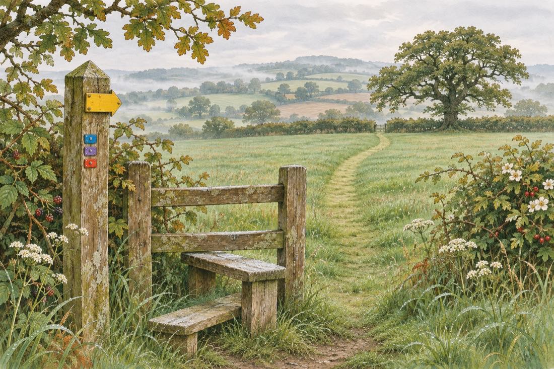
What a public footpath is
A public footpath is a way over land where the public has a legal right to pass on foot. The land can still belong to a farmer, an estate or a householder. The owner keeps the ground, and everyone keeps the right to walk the line of the path. That is why a footpath can run through the middle of a working field or a garden edge without being a trespass.
In England and Wales these routes are recorded on a legal document called the definitive map, kept by the local highway authority. Scotland and Northern Ireland have their own systems, and in Scotland a wider set of access rights applies to much of the land, so the details below describe England and Wales unless stated.
Footpath, bridleway, byway: the four types
Rights of way come in four main kinds. A footpath is for walkers. A bridleway is for walkers, horse riders and cyclists. A restricted byway adds horse-drawn carriages and other non-motorised traffic. A byway open to all traffic, often shortened to BOAT, may also be used by motor vehicles, though the surface is usually rough and many are used mainly by walkers and riders.
The type of a route matters because it decides who may use it. Cycling on a footpath, for example, is not a general right, while a bridleway welcomes bikes. When in doubt, the sign or the map will say.
Waymark colours
Many rights of way carry small arrows on posts, stiles and gates. The colours follow a common code across England and Wales:
- Yellow marks a footpath.
- Blue marks a bridleway.
- Purple marks a restricted byway.
- Red marks a byway open to all traffic.
Not every path is waymarked, and arrows can fade or go missing, so treat them as a help and not as the whole answer.
Crops, fields and livestock
A path may cross a field of crops. Where the path is clear on the ground, walkers should keep to it in single file, even if that means treading a narrow strip of the crop, rather than walking around the edge and widening the damage. Farmers who plough or plant over a path are expected to restore a usable line.
Fields with animals call for calm. Keep dogs under close control, give cattle and their calves a wide berth when you can and leave a gate as you found it. The Countryside Code sets these habits out in more detail.
Finding the route on a map
The most reliable source is the definitive map and the council that keeps it, which you can usually view online or ask to see. Printed walking maps also show rights of way, and several national and local map services overlay them. If a route on your map is blocked or missing on the ground, the highway authority is the right body to tell, and many councils have a simple online form for reporting a problem.
For a short official summary of using public rights of way, see the guidance on GOV.UK.